Technical information
Intelligent Road Construction, GNSS Stringless System NSP System


Category :
-
Paving Methods > Roadway > Construction Technology >
Improved safety and paving accuracy and can accommodate the centralized management of multiple paving machines
Overview
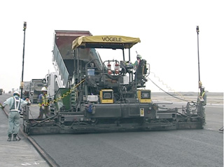
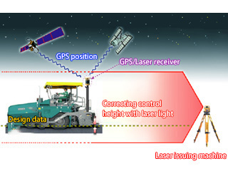
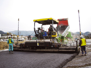
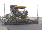
A computerized paving system based on the use of a global navigation satellite system (GNSS) and zone laser technology. Based on 3D design data and position information received from GNSS, paving machines such as motor graders and asphalt pavers are automatically controlled with high accuracy.
Features
- Streamlining of work: In addition to reducing the amount of work required for setting up and inspecting finishing stakes, the integrated management of multiple paving machines enables the shortening of the construction period.
- High-precision paving: Automatic control ensures that the road surface height is finished with precision to the nearest millimeter and that a uniform surface finish is properly provided.
- Improved safety: A reduced need to engage in measurement work prevents accidents involving contact between workers and heavy machinery.
- Reduced environmental impact: Less time working allows for lower levels of CO2 emissions from construction machinery.
Uses
- Highways
- Major roads
- Airports
- Large parking lots